iSPECIAL OFFER: Price includes Shipping and local VAT/Taxes where applicable | We ship to EU, UK, USA, Canada, Australia and New Zealand | We ship Framed Prints only to USA, UK and EU at this time.

Buy Old Map of North America 1762
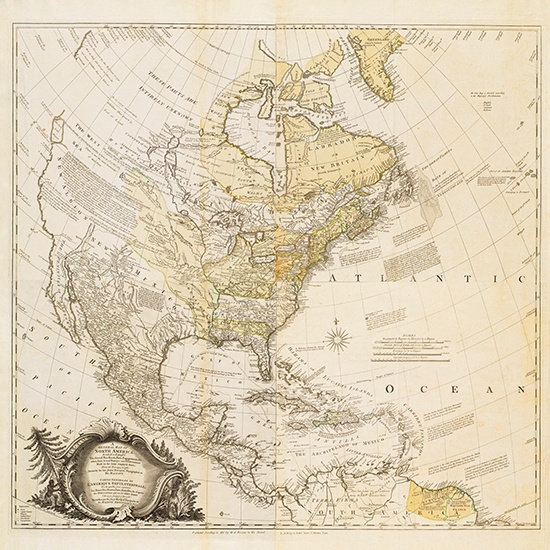
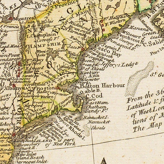
Step into the past with a large print of our remarkable 1763 General Map of North America by Jean Rocque. This vintage treasure of the old west is more than just a geographical representation; it's a portal to the history and tales of Old America. Dive into the intricate details that tell stories of a time long gone.
Step into the past with a large print of our remarkable 1763 General Map of North America by Jean Rocque. This vintage treasure of the old west is more than just a geographical representation; it's a portal to the history and tales of Old America. Dive into the intricate details that tell stories of a time long gone.
- NOTE on Sizes: As these old maps are of a non-standard ratio, width to height, they will be printed with their narrow side corresponding to the narrowest side of the photopaper size chosen. This means that there may be a white non printed strip along the bottom edge of the image that will need trimed before mounting.
- The fine detail illustrated may not be readable on the smaller sizes.
- Chose a large size to render the high detail.
Journey Through Time
Immerse yourself in the rich narrative of the 1763 General Map of North America. Each contour and symbol on this old map of America tells a story of exploration, settlement, and the dynamic landscape of the continent in the 18th century. Let's embark on a journey through time.
Rocque's Masterpiece
Created by the skilled hands of Jacques-Nicolas Bellin, this masterpiece provides a unique perspective of North America in 1763. Rocque's attention to detail and artistic flair make this map not just a navigational tool but a work of art, capturing the spirit of Old America.
Colonial Influences
The detailed depiction of colonial territories on this old America map showcases the intricate network of European powers during this period. Witness the territorial boundaries and the influence of nations such as France, Spain, and Britain, shaping the destiny of the continent.
Indigenous Insights
Delve into the fascinating representation of indigenous communities scattered across the map. The artwork encapsulates the diverse cultures, highlighting the nuanced interactions between Native American tribes and European settlers. It's a window into the complex tapestry of Old America.
Strategic Fortifications
One cannot ignore the strategic importance of the numerous forts meticulously marked on the map. These strongholds were pivotal in shaping the geopolitical landscape, representing the ongoing struggles for dominance in North America during the 18th century.
Trade Routes and Waterways
Trace the vital trade routes and waterways that played a crucial role in the economic development of Old America. The map vividly illustrates the interconnected network of rivers and trails that facilitated the exchange of goods and ideas.
Enigmatic Cartographic Symbols
Decipher the enigmatic symbols scattered across the map, providing insights into the flora, fauna, and geographical features of Old America. From mountain ranges to indigenous wildlife, each element contributes to the rich tapestry of this historical gem.
Decor and Conversation Starter
Transform your space with a touch of history. Our prints of the 1763 General Map of North America by Rocque aren't just wall art; they're conversation starters. Add a touch of vintage charm to your surroundings and let the stories of Old America unfold.
Thanks to Pictureboxblue

