iSPECIAL OFFER: Price includes Shipping and local VAT/Taxes where applicable | We ship to EU, UK, USA, Canada, Australia and New Zealand | We ship Framed Prints only to USA, UK and EU at this time.
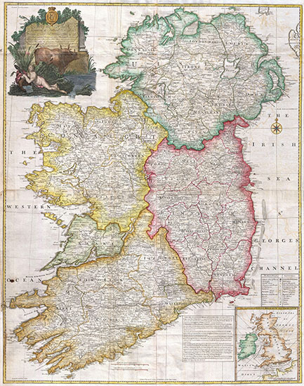
Buy Old Reproduction Map of Ireland 1794: by Jean Rocque
Step back in time with a high quality reproduction print of the 1794 Rocque Wall Map of Ireland, an exquisite cartographic masterpiece that unfolds the rich tapestry of Ireland's past. This old map of Ireland beckons us to explore its intricate details, unveiling a bygone era. Printed on 275gsm photo paper, unframed.
Step back in time with a high quality reproduction print of the 1794 Rocque Wall Map of Ireland, an exquisite cartographic masterpiece that unfolds the rich tapestry of Ireland's past. This old map of Ireland beckons us to explore its intricate details, unveiling a bygone era. Printed on 275gsm photo paper, unframed.
- NOTE on Sizes: As these old maps are of a non-standard ratio, width to height, they will be printed with their narrow side corresponding to the narrowest side of the photopaper size chosen. This means that there may be a white non printed strip along the bottom edge of the image that will need trimed before mounting.
- The fine detail illustrated may not be readable on the smaller sizes.
- Chose a large size to render the high detail.
The Tapestry of Old Ireland: A Cartographic Masterpiece Unveiled
Imagine holding in your hands a tangible piece of history, a snapshot of Ireland frozen in time. The 1794 Rocque Wall Map of Ireland offers just that—a captivating journey through the past. As you trace the delicate lines and study the intricate details, the map comes alive with stories of old Ireland.
Unraveling the Narrative: Cities, Towns, and Landmarks
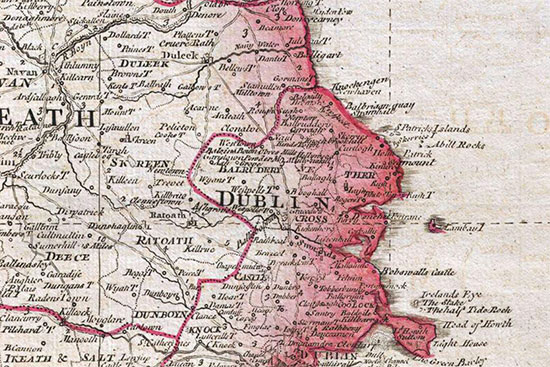
This old map of Ireland is not just a geographical representation; it's a visual narrative of the Ireland of 1794. Cities and towns are meticulously marked, each carrying its unique story. Dublin, Belfast, Cork—their positions on the map tell tales of commerce, culture, and the bustling life of the time.
The Richness of Topography: Mountains, Rivers, and Coastal Lines
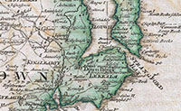
Beyond human settlements, the 1794 Rocque Wall Map of Ireland beautifully captures the natural beauty of the land. Majestic mountains, meandering rivers, and rugged coastlines are etched with precision, offering a glimpse into the diverse topography that shaped Ireland's history.
Aristocratic Estates and Historical Residences: An Insight into Old Ireland's Elite
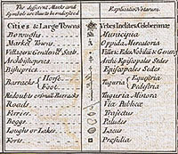
Delve into the map's details, and you'll encounter markers of aristocratic estates and historical residences. Each symbol on the map whispers tales of the elite class, their influence on the landscape, and the societal dynamics of old Ireland.
Intricacies of Roads and Travel: Navigating Old Ireland
In a time before highways and expressways, the Rocque Wall Map intricately outlines the roads and travel routes of old Ireland. Follow the winding paths and discover how our ancestors navigated the landscape, linking towns and cities in a web of historical connectivity.
A Glimpse into Economic Hubs: Ports, Markets, and Trade Routes
The map is not just a static representation but a dynamic window into Ireland's economic hubs. Ports, markets, and trade routes are meticulously detailed, shedding light on the flourishing commerce that characterized old Ireland.
The Evolution of Cartography: Rocque's Legacy
As we marvel at the Rocque Wall Map, it's essential to appreciate the craftsmanship and artistry that went into its creation. John Rocque, the cartographer behind this masterpiece, left an indelible mark on the world of cartography, influencing generations to come.
Preserving History: The Importance of Old Maps
The 1794 Rocque Wall Map of Ireland is not merely a relic; it's a testament to the importance of preserving historical artifacts. Old maps provide us with a tangible link to the past, enriching our understanding of cultural, social, and economic landscapes.
Conclusion: Rediscovering Ireland Through the Lens of History
The 1794 Rocque Wall Map of Ireland is not just an old map; it's a portal to another time. As we trace the contours and explore the details, we embark on a journey through the heart of old Ireland. This cartographic gem invites us to unravel the mysteries, stories, and nuances of a bygone era.
Thanks to Pictureboxblue

